Grants
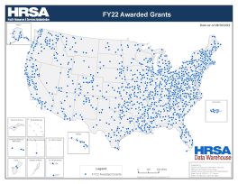
FY25 Awarded Grants
This map displays the geographic distribution of HRSA grantees with awarded grants in fiscal year 2025 managed by different bureaus and offices within HRSA.
Data Sources: HRSA Awarded Grants as of 09/30/2025 Text view of data
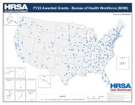
FY25 Awarded Grants - Bureau of Health Workforce (BHW)
This map displays the geographic distribution of awarded grants in fiscal year 2025 managed by Bureau of Health Workforce (BHW).
Data Sources: HRSA Awarded Grants as of 09/30/2025 Text view of data
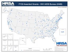
FY25 Awarded Grants - HIV/ AIDS Bureau (HAB)
This map displays the geographic distribution of awarded grants in fiscal year 2025 managed by HIV/AIDS Bureau (HAB).
Data Sources: HRSA Awarded Grants as of 09/30/2025 Text view of data
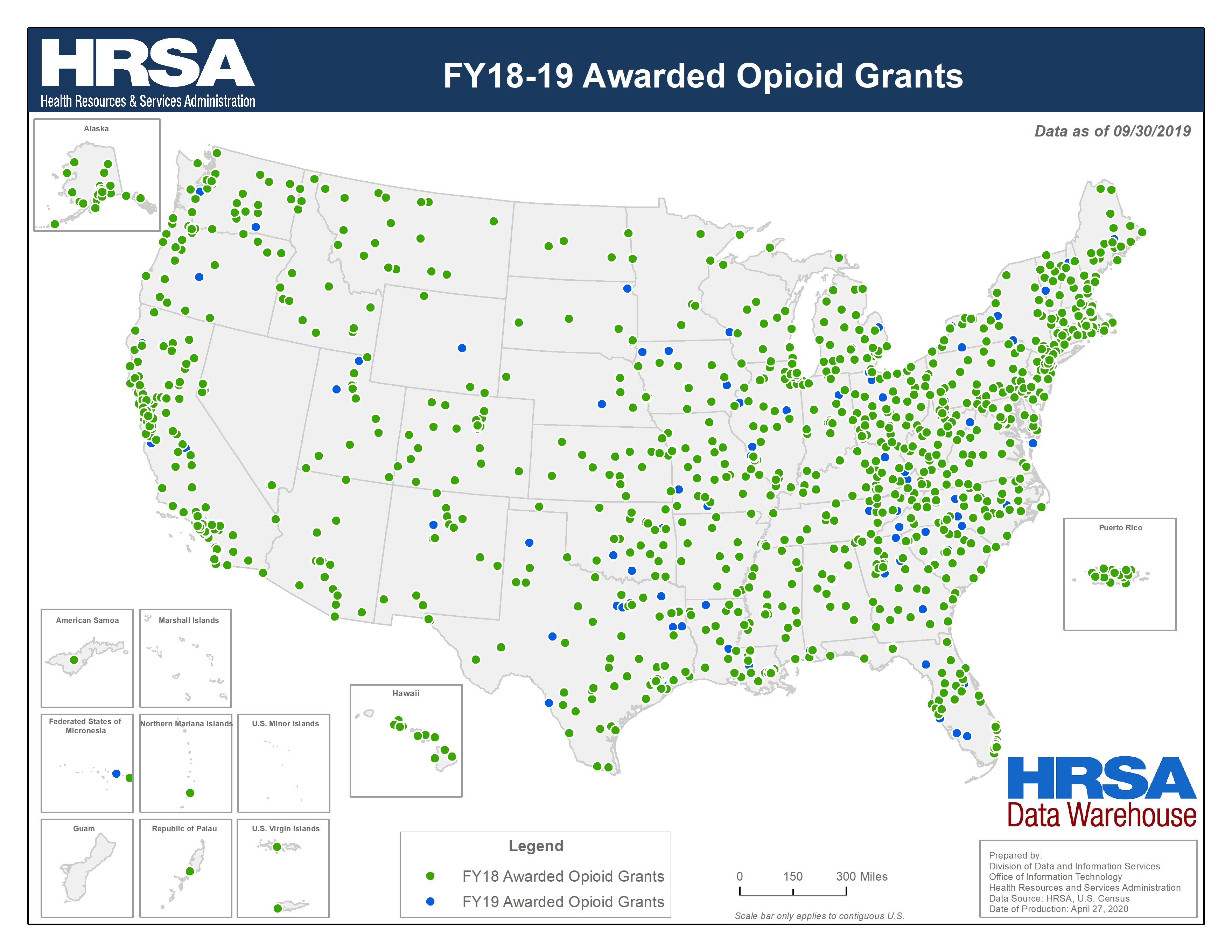
FY18-19 Awarded Opioid Grants
This map displays the geographic distribution of awarded opioid grants in fiscal years 2018 and 2019 managed by different bureaus and offices within HRSA.
Data Sources: HRSA Awarded Grants as of 09/30/2019 Text view of data